

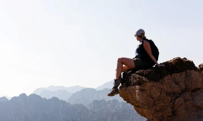
About Hatta Hiking in Dubai

Suitable for beginners, novice walkers, and trail runners, the easy trail on Hatta hiking is termed Green on the map. The surface of the trail is very easy for hiking as it is wide and flat with a slight elevation at the time of ascent. The descents are not deep, but relatively easy to perform. The nature of the trail is sandy and uneven at some points but it is simple altogether. The green trail has low climbs, making it easier for an inexperienced hiker to move effortlessly. First-timers and beginners experience Hiking in Hatta through the simple green trails.
Fitness Level: Average to Good Health
Distance: 5.5 Kilometers

Moderate trails are a type of easy trail with the added difficulties of obstacles. These trails are represented by Blue on the map as they are a level above the green trails. This kind of trail has small rocky obstacles to cross for successful Hiking in Hatta. The technical features and gradients of the trail are average with steep climbs in ascents **and descents. However, the obstacles are not too tough to crack as they are fewer in number. The average 10.5 kilometers of hiking distance is also neither difficult nor easy. This makes the moderate trail suitable for intermediate walkers and runners.
Fitness Level: Standard Fitness and Stamina
Distance: 10.5 Kilometers

The Difficult trails offer a tough path suitable for professional trail runners and walkers. These Hatta Hiking Trails are represented by Red color on the map as it requires high levels of effort and stamina. The surface of the trail is rough, steep, narrow, and rapidly changing with short stone staircases throughout the journey. The ascents and descents are tough as it is a single track with technical sections. It is advised to use hiking poles while moving through the trail to avoid any inconvenience. Besides the precautionary measures, you can do quality off-road mountain biking on this trail to boost your adrenaline.
Fitness Level: High Level Fitness and Stamina
Distance: 7.9 Kilometers

Out of all Hatta Hiking Trails, the Severe trail is the toughest one to crack. Marked by Black on the map, this trail is suitable for expert walkers and trail runners that have prior experience. The strenuous trail has the same narrow, rough, steep, and rapidly changing features as the red one but with greater exposure to heights. The technical features of the trail are large, prolonged, and unavoidable. You may even require your hands for a few ascents or descents, it is strongly recommended to use hiking poles.
Fitness Level: Extremely High Level of Fitness and Stamina that sustains for a long time (Usually Professional Athletes and Mountaineers)
Distance: 8.7 Kilometers
Know Before you Plan You Hiking for Hatta
- Things to keep in mind:
You must check your fitness levels and experience in hiking before choosing the type of Hatta Hiking Trails.
Inform your dear ones prior as there is no network on the hike.Carefully understand the nature, distance, and elevation of the trail before choosing yours.
Follow the map carefully and don’t ignore any warning signboards.It is mandatory to carry hiking poles on red and black trails.
- Highlights:
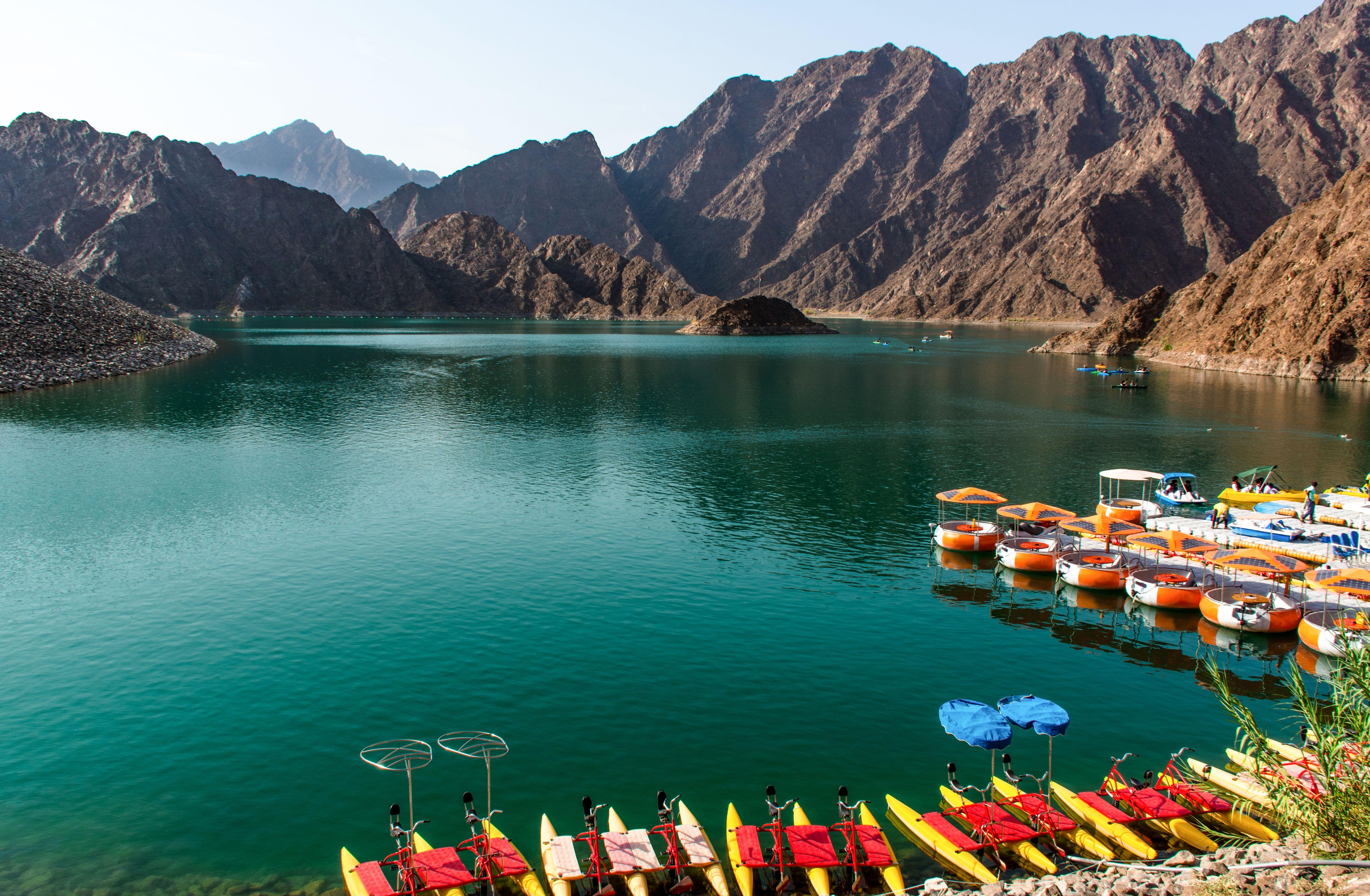
Explore the mountains of Hajar through the Wadis of Hatta encompassing the view of an enchanting lake.
Enjoy the thrilling journey on four different trails according to the level of thrills.
Witness the traditional hill culture of the ancient villages of Hiking in Hatta.
Say hello to the beings of mountains- gazelles, monkeys, donkeys, and magnificent birds.
Backpack for Hiking
3+ liters of water
Electrolytes
Wear Hiking Shoes with good grip that are suitable for the toughest terrain
Protection against Sun: Sunglasses, Sunscreen and Hats
Medical and First-Aid kit
Snacks like protein bars, biscuits, glucose based chocolates etc.
Hiking Poles
FAQ's of Hatta
What are the important things to keep in mind while going hiking in Hatta?
- Keep electronic devices charged as there is no electricity.
- Take the map handy in your backpack for navigating through the hike.
- Ensure that you are wearing the right clothes and hiking shoes.
- Make sure you carry all necessary and important safety equipment in your backpack.
- Be on alert while on the difficult and severe trails.
- Follow official signboards and directions- don’t miss the warning signs.
- Keep nature clean and maintain proper sanitization by using the assigned shower and toilet facilities.
- Don’t litter on Hatta Hiking Trails, you should throw the waste in dustbins, or designated areas.
Do Checkout: Dubai Dolphinarium
What is the best time to visit Hatta?
You can enjoy Hiking in Hatta and other adventurous activities either in September - October or February - March. This is because these months witness the spring and autumn seasons. Adventure recreation takes place in these seasons only as no such activities happen during summers and winters. Hence, summers and winters are closed for Hatta.
How to reach Hatta?
By Bus: You can board a bus from Dubai International Airport and Hatta at a distance of 125 kilometers. The bus halts at multiple locations, stretching the journey to 3 hours.
By Cab/Taxi: You can board a cab/taxi to Maliha Road and follow the E-102 route. You will reach Hatta in approximately 2 hours.
What are the other things to do at Hatta?
- Visit the dam of Hatta: Hatta Dam is an enchanting place visible from the horizon, surrounded by mountains and lakes across all the boundaries. Witnessing this dam during the sunset and clicking Insta-worthy pictures is a cool way to end your day in Hatta.
- Hatta Heritage Village: The mountainous village will amaze you with its ancient traditional culture. Sculptures, carvings, prototypes, and many other things are visible throughout the ancient village.
- Go on a Hike: Hiking in Hatta across four different trails is an enthralling thing to do in the mountains. The hiking experience will put challenges across the journey for you to get the rush of adrenaline.
- Sightseeing: Besides the adventurous activities, Hatta is visually pleasing with its beauty of mountains, lakes, flora and fauna.